Software Name:
TRANSDAT (Deutsch)
Version: 14.07
Category: Business
Date Listed/Updated: 2011-03-05 13:48:33
File size: 35 KB
OS: Win95,Win98,WinME,WinNT 3.x,WinNT 4.x,WinXP,Windows2000,Windows2003,Windows Tablet PC Edition 2005,W
License: Other Price($): 200.00
Author/Publisher name: Fred Killet
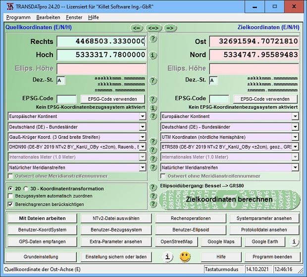
View Full Screenshot
Description: TRANSDAT Geosoftware executes coordinate transformations and geodetic datum shifts between many coordinate and reference systems of America, Australasia, Europe, Germany special and world-wide, at high precision and high speed: 1.The current and historical coordinate and reference systems of all countries of the European Union (EU) including the eastern extensions and the systems of non-EU countries. 2. The INSPIRE supported European ETRS89 systems. 3. The US and Canadian State Plane Coordinate Systems (SPCS) on NAD27 and NAD83 and other coordinate systems of the North American continent. 4. The coordinate and reference systems of the Australasian continent. 5. Many coordinate and reference systems of the countries of other continents. 6. World-wide NTv2 grid file supported coordinate transformations. 7. All world-wide coordinate and reference systems in current use. 8. The German coordinate and reference systems of the old and new federal states, the 40 Prussian Soldner Land Registers, the German Lagestatus, and exact reference systems of the German federal states. You will find a complete list of the coordinate and reference systems supported by the program on the internet or after downloading the free test version of the program. The NTv2 standard with national grid files is world-wide full supported. Apart from the given world-wide and state-specific systems, your own personal coordinate systems and geodetic reference systems can be defined with Helmert (Bursa / Wolf, ISO19111) or Molodenski parameters. Calculations can be performed with coordinates entered directly, loaded from files in various formats (Text, CSV, SDF, dBase, ArcShape and ArcGenerate), or passed via batch processing. ArcShape files can be viewed with the program-internal Shape Viewer. A programmable GPS interface makes it possible to read coordinates into a notebook computer from a low-cost GPS antenna. The program can be run on a network, in which case clients are installed automatically.

EULA

Tags: coordinate coordinates conversion converter convert transformation transform system datum grid shift
Is this software spam? Report Spam
Software removal request by publisher Removal Request
Software Review: TRANSDAT (Deutsch) Review
For publisher: Request Software Confirmation
Press release from the publisher:KilletSoft s Spatial Software supports new Reference System GDA2020 of Australia
The coordinate reference system MGA2020 GDA2020 for the Australian continent, valid since the beginning of the year, now can be used in KilletSoft s Coordinate Transformation Program TRANSDAT and in the Geodetic Development Kit GeoDLL.
Since the implementation of the previous Australian datum, the Geocentric Datum of Australia 1994 (GDA94), the Australian plate has moved about 1.6 meters northeast. The coordinates defined in the GDA94 no longer match the current measurements of the global satellite navigation system GPS. Differences of this magnitude are, for example, for navigation of self driving vehicles, for automated mining and precision agriculture and for cadastral surveys no longer acceptable. To address the problem, Australia has implemented a new datum known as the Geocentric Datum of Australia 2020 (GDA2020).
The change to GDA2020 will affect all organizations in Australia that are using spatial information including transport, agriculture, construction, mining, environmental protection, utilities management, insurance, banking, emergency services, telecommunications and scientific research.
GDA2020 logo Following the publication and approval of the new coordinate reference system by the Australian authorities, KilletSoft has integrated the GDA2020 MGA2020 into its TRANSDAT and GeoDLL software. This software also supports the two variants of the new high-precision NTv2 grids GDA94_GDA2020_C and GDA94_GDA2020_CD, which have just been released for the continent-wide conversion between GDA94 and GDA2020. Both grid files and a detailed explanation can be downloaded directly from the KilletSoft website http: www.killetsoft.de homee.htm by clicking on the entries TRANSDAT or GeoDLL in the navigation bar and then using the link to the NTv2 page. There you will also find a compilation of the worldwide free available NTv2 files.
Killet Software Ing.-GbR
Escheln 28a
47906 Kempen
Germany
killet@killetsoft.de
infokilletsoft.de
Visit the Press Release for more details
Software from the publisher:GeoDLL, Geodata Germany, TRANSDAT (Deutsch), Graphics4VO Demo, Graphics4VO Graphics DLL 5.14, Geodata Germany, Geodata International, Geodaten International Streets 3.01, Geodata International, Geodaten International Houses 3.00, Geodata Germany, Geodaten German Streets 3.02, CONVERT, CONVERT (Deutsch) 3.03, Geodaten German Houses 3.02, Geodaten German Admin 13.04, Geodata International, GEODLL32 (English) 11.11, Graphics4VO Beispiel Programm 5.14, Graphics4VO Graphik-DLL 5.14, Geodata Germany, TOPOWIN, SEVENPAR (Deutsch), SEVENPAR (English) 1.10, ORTWIN, Geodaten International Admin 3.02, DRAGSENS, NTv2Tools, NTv2Poly, TRANSDATpro, GeoDLL, SEVENPAR, TOPOWIN, Geodata Germany, Geodata International, NTv2Creator,